One of the central missions of the Inuit Heritage Trust (IHT) is preserving the traditional names of geographical features and landmarks in Nunavut. But time is not on the organization’s side, as the people who remember those traditional names are disappearing – particularly in communities like Resolute Bay and Grise Fiord.
“There were people who made it their business to remember these place names,” IHT traditional place names manager Lynn Peplinski said from Iqaluit. “But they’re getting old. Most of them have passed on.”
The process of preserving a place’s official name is complicated.
It begins by interviewing elders living in the region, and recording the names they provide on maps, in Inuktitut syllabics. Those maps are later printed on waterproof paper and distributed for free. IHT also contributes the names it discovers to the popular digital mapping platform SIKU.
The organization has already done that much in many regions of Nunavut.
Peplinski estimates her two-person team has documented the traditional names of roughly 600 places around Naujaat, some 550 around Gjoa Haven, and another 550 around Iqaluit – where she says one elder contributed “100 names in an hour.”
They began to do the same in Resolute in 2007, and Grise Fiord in 2009, but fell far short of the numbers they achieved elsewhere.
“It’s because there’s been a longer history of occupation in all the other places [we’ve mapped],” Peplinski said, referencing the High Arctic relocation of the 1950s, when people from Northern Quebec and Pond Inlet were coerced into moving to Resolute Bay and Grise Fiord in an effort to affirm Canadian sovereignty in the North. “Their history doesn’t go back that long.”
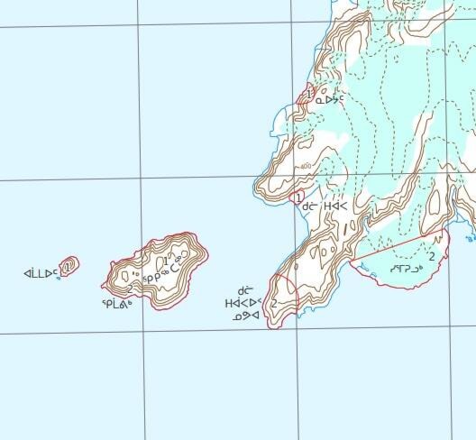
The geographical features around Resolute Bay and Grise Fiord had names before the communities themselves were populated by people from further south. Some of those names were given by Europeans, but other places in the two regions were given traditional Inuit names.
Peplinski points to Polar Bear Pass, a mountain pass to the northwest of Resolute Bay, as an example.
During her team’s 2007 interviews in the community, elders referred to Polar Bear Pass by the name Kitturajjaq which, like many traditional names, describes the area’s physical features. However, people in the community no longer use that name, referring to the pass by its English name or the rough Inuktitut translation, Nanuit Itillinga.
“The current generation doesn’t remember Kitturajjaq,” she said. “[The name] Kitturajjaq has nothing to do with polar bears.”
“That’s why the maps are important,” she added. “We need to have that knowledge written down from those elders, and available to these new generations so they can remember and stay connected to that knowledge.”
“If people don’t have paper maps to look at and pour over and share, they don’t necessarily remember all the names.”
IHT aims to ensure no more names go the way of Kitturajjaq. Unfortunately, preserving the name of a place is not as simple as printing it on a map or adding it to SIKU.
“You can only protect these names long-term if they’re official,” she said. “If it’s in the Canadian system, it’s good for hundreds of years. Until then, it’s vulnerable.”
For a name to be made official – as far as the Canadian government is concerned – it must first be submitted to Nunavut’s toponymist, based in Iglulik. The toponymist then reviews the validity of the submitted name. If the name meets the requirements, it is submitted to the Minister of Culture and Heritage, and finally passed on to federal government staff, who add it to official maps of the country.
It’s a slow process from the beginning, because Nunavut’s toponymist is “a single person with no support staff,” according to Peplinski. While IHT has succeeded in making the names of places around Pond Inlet, Kimmirut, and Kinngait official, the organization submitted names on 27 maps in 2011 and 2012, and all of those remain unofficial.
“There’s still thousands and thousands of names that we need to make official,” she said.
“The people that live in the local area, they should have the priority when it comes to naming their area, because they live there,” she said. “It’s important to Canada and it’s important to Nunavummiut.”